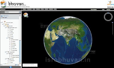
The satellite based 3D mapping application from Indian Satellite Research Organization (ISRO) Bhuvan will enable users to take satellite data more closely compared to Google Earth.
 |
| ISRO's Bhuvan a mapping application |
The registered users will be able to browse and download satellite data through the ISRO's National Remote Sensing Centre's Open Earth Observation Data Archive situated at different cities of India.
Bhuvan has advanced features than the Google Earth as it allow users to zoom far closer than the aerial view from a chopper.
The google earth shows details up to 200 metres of distance and Wikimapia shows up to 50 metres. But Bhuvan will show images up to 10 metres, which means a user can view details up to a three floor high building. Moreover, google earth only works on a downloadable client while Bhuvan works within the browser of the user.
At present users can download elevation data of CartoDEM-1arc second and Resourcesat-1: AWiFS data (56m) of the Indian region and soon users will be able to access additional data when Bhuvan will be equipped with more modern technology.
Google Earth Vs ISRO Bhuvan
Google Earth
* Zoom levels up to 200 mt
* Single layer information
* Images upgraded every 4 years
* No alternate viewing options
* Uses international satellites
* Single layer information
* Images upgraded every 4 years
* No alternate viewing options
* Uses international satellites
ISRO Bhuvan
* Zoom levels up to 10 mt
* Multi-layer information
* Images upgraded every year
* Options of viewing on different dates
* Uses Indian satellites
* Multi-layer information
* Images upgraded every year
* Options of viewing on different dates
* Uses Indian satellites
No comments:
Post a Comment